
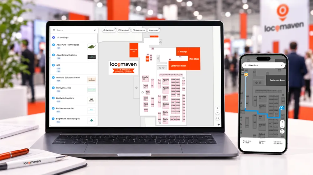
LocoMaven is a managed interactive mapping service for trade shows, conferences, expos, and fairs. It transforms existing floor plans into browser-based maps that help attendees search for exhibitors, explore profiles, save favorites, and get walking directions. Designed for standard single-floor events, LocoMaven delivers a ready-to-use map within three business days, without requiring organizers or partners to build or maintain mapping software.
A floor plan answers one question: what is where. Attendees at even relatively small events need answers to several others: which exhibitors offer what they’re looking for, where a particular stand or session is, and the quickest route from where they are now. A static PDF leaves the visitor to work all of that out for themselves.
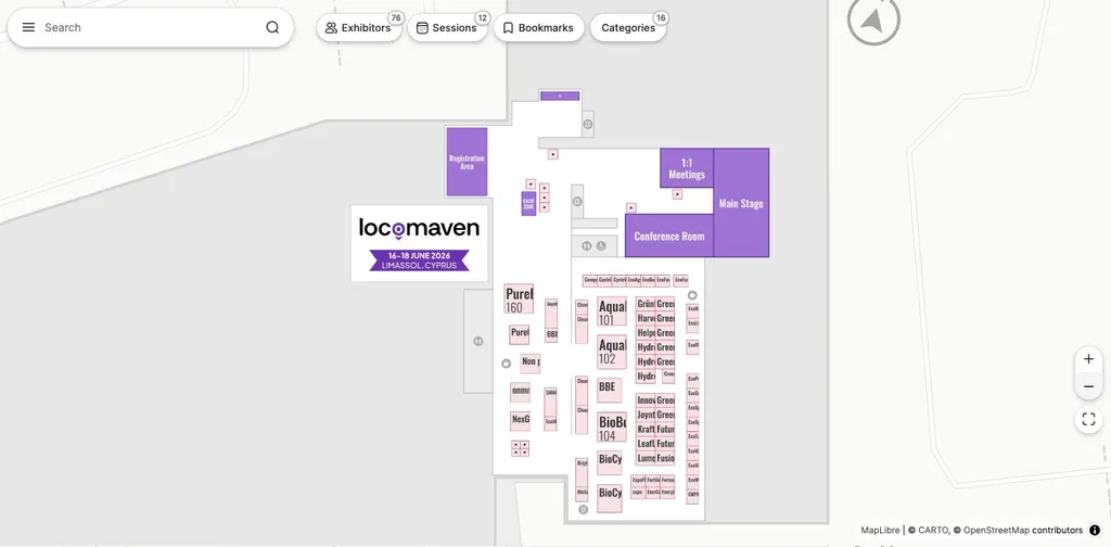
An interactive floor plan in the browser: the map, exhibitor list, session programme, bookmarks and category filters all sit on one screen. Source: lmdemo.locomaven.com
This isn’t only a problem for large exhibitions. A smaller show can still be difficult to navigate on a phone, especially when the exhibitor list, programme and venue information sit separately from the floor plan. Smaller events may also have fewer staff on hand to answer wayfinding questions on site.
The case for moving beyond PDF isn’t about adding technology for its own sake. It’s about reducing the effort required to discover exhibitors and navigate the event. At one end of the market, a static PDF is inexpensive but can’t provide search, filtering or directions. At the other, enterprise platforms may offer more technology than a smaller event needs.
For event suppliers, the opportunity lies between those extremes. Rather than developing mapping technology internally, a registration provider, event app company, agency or venue can use a fixed-scope managed service such as LocoMaven as its production layer, add interactive mapping to its portfolio and sell it as a standalone product or as part of a wider client package.
Why interactive mapping matters to partners
Clients increasingly prefer to buy connected services from a smaller number of trusted suppliers. A registration provider may already manage attendee data. An event app company controls the digital experience. A venue understands the physical environment, while an agency oversees the wider delivery.
Interactive mapping is a natural extension for each of these businesses. Adding it to an existing package creates an extra revenue stream and makes the core service more useful. It also strengthens the client relationship – rather than bringing in a separate mapping supplier, the existing partner stays the main point of contact.
There are four main ways to deliver this capability.
1. Static PDFs and image-based plans
The simplest option is to publish the existing floor plan as a PDF or image. It’s inexpensive, familiar and needs no specialist software.
For an event with only a handful of locations, that may be enough, but a smaller event isn’t automatically easy to navigate. Once a visitor has to choose between dozens of exhibitors, identify companies by category, locate sessions or find facilities, the limits of a document-based plan show.
On a phone, visitors have to open the file, zoom into small labels and switch between the map and a separate exhibitor list. Knowing an exhibitor’s name isn’t enough if the PDF only shows booth numbers. The plan can display the layout, but it can’t search exhibitors, filter by category, open profiles, save favourites or give walking directions.
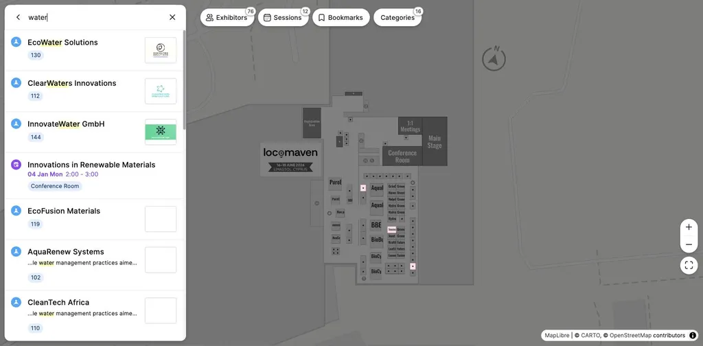
Keyword search: one query returns matching exhibitors with their booth numbers and a related session, and highlights the stands on the plan. This is the function a document-based plan cannot provide.
Each missing function pushes work back onto the attendee or the organiser’s on-site team – something felt most at smaller events with limited operational staff. For partners, a PDF is easy to supply, but it leaves little room for differentiation, packaging or extra revenue.
Best suited to: very small events with simple layouts and limited exhibitor content.
Main advantage: minimal cost and preparation.
Main limitation: little interactivity or additional commercial value.
2. Custom development
A partner can build its own mapping functionality or commission a bespoke solution.
This offers the greatest control over branding, integrations and the user experience. It may make sense for a technology company with its own development team and a large number of clients needing similar functionality.
But mapping is more complex than displaying an image. Search, routing, responsive behaviour, content management and cross-device compatibility all need development and ongoing support.
The initial build is only part of the cost. The partner also has to maintain the product, process floor plans and support clients when layouts change.
Best suited to: technology companies with sufficient scale and internal development resources.
Main advantage: complete product and integration control.
Main limitation: significant development, production and support requirements.
3. Enterprise mapping platforms
Enterprise platforms are designed for large exhibitions, convention centres and complex event portfolios. They can offer multi-floor navigation, indoor positioning, native app integrations, SDKs, advanced sponsorship products and managed onboarding.
Enterprise-tier capabilities sit above what a standard single-floor exhibition typically needs.
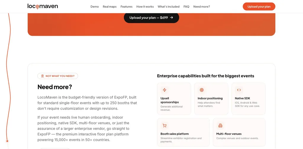
Enterprise-tier capabilities — indoor positioning, native SDKs, multi-floor venues and booth sales platforms — sit above what a standard single-floor exhibition typically requires.
For major events they may be essential, but for a standard single-floor show the implementation process and commercial model can be disproportionate to the requirement.
Partners should therefore consider whether their clients genuinely need enterprise functionality or simply want attendees to find exhibitors more easily.
Best suited to: large or complex events requiring customisation and deep integration.
Main advantage: extensive functionality and scalability.
Main limitation: greater cost, onboarding and technical complexity.
4. Fixed-scope managed mapping
A newer model sits between static plans and enterprise platforms: a fixed-scope service where the organiser or partner supplies the source files and a specialist team produces the interactive map. This approach avoids internal development while giving the partner a predictable product to include in client proposals.
LocoMaven is built around this model. Partners submit a PDF, DWG, DXF or high-resolution floor-plan image, and a completed interactive map is delivered within three business days for a fixed price of $699.
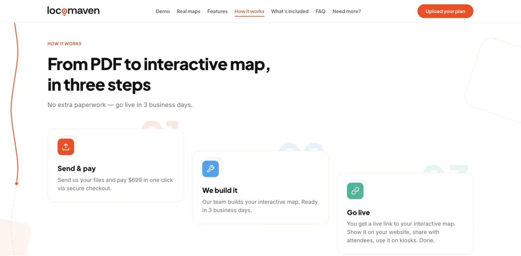
The fixed-scope production model in three steps: the partner sends the source files, the map is produced, the event goes live within three business days.
The service is designed for standard single-floor trade shows, conferences, expos and fairs with up to 250 booths. Attendees can search by exhibitor, booth number, category or keyword, open exhibitor profiles, save favourites and get walking directions. The map runs in a browser and can be embedded into an event website, linked from an existing event app or displayed on an on-site kiosk.
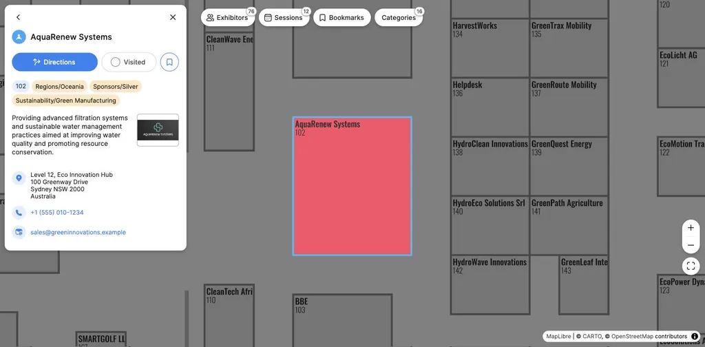
An exhibitor profile opened from the booth: category and sponsor tags, description, address, phone and email.
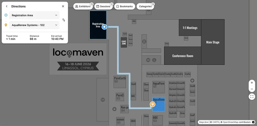
Walking directions from the registration area to booth 102, with distance and estimated arrival time.
For partners, the fixed input cost and defined delivery time make the product easier to include in proposals and wider service packages. Map production and content import are handled externally, so the partner doesn’t need to build or run a mapping platform.
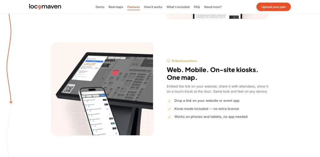
The same map on a website, a phone and an on-site kiosk — no separate application required.
Best suited to: partners serving small and mid-sized events with standard layouts.
Main advantage: predictable pricing and delivery without internal development.
Main limitation: not intended for multi-floor venues or highly customised enterprise projects.

Fixed scope stated up front: what the $699 package includes, with no add-on tiers.
Choosing the right model
No single approach suits every event. A static plan may be enough for a simple local event. A large international exhibition may require an enterprise deployment. Between those two sits a broad segment of organisers that want a professional interactive map without a lengthy software project. That is the portfolio opportunity for registration providers, event app companies, agencies and venues.

Live maps produced under the same model for trade shows, conferences and expos in different venues.
The objective is not to replace every existing mapping option. It is to give partners an additional product for clients whose requirements have outgrown a PDF but do not justify an enterprise platform.
Live example: https://lmdemo.locomaven.com/